Take a drive on the wild side with Vildmarksvägen - Sweden's Wilderness Route
Vildmarksvägen - Sweden's Wilderness Route
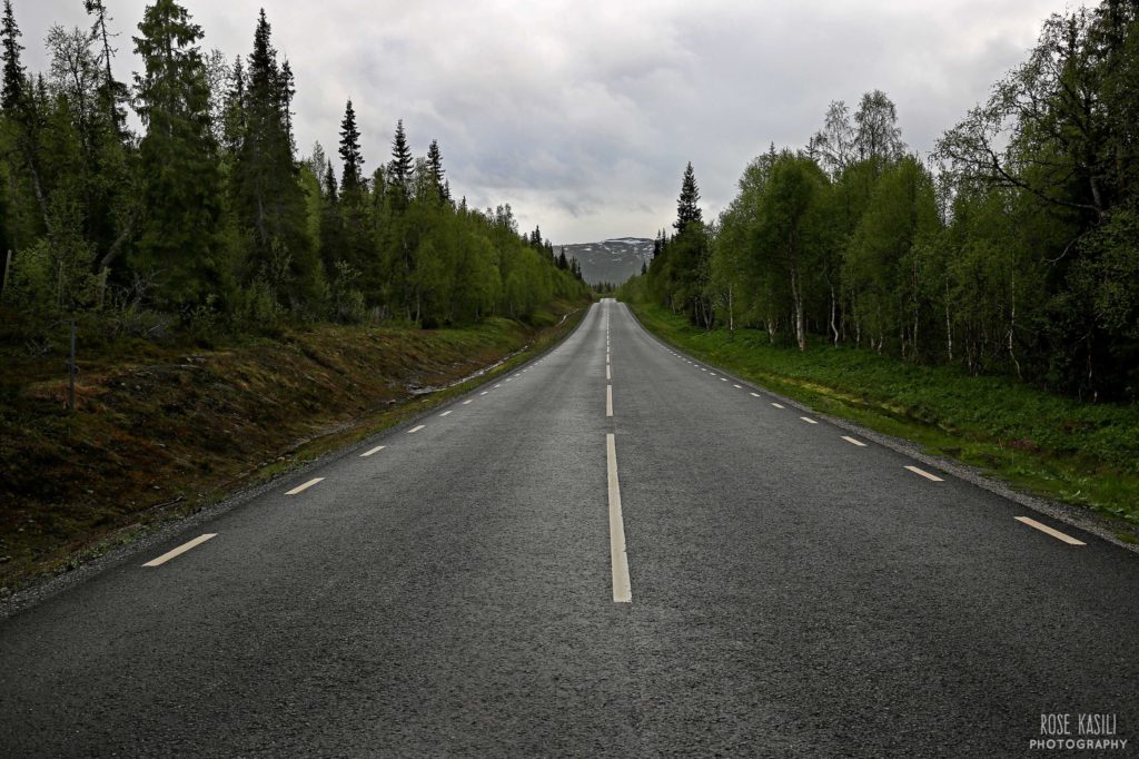
Glancing at a world map you probably wouldn’t give it too much thought, but Sweden is actually a big country. Really BIG! It’s the third largest in Europe but despite all that space, it has one of the smallest populations. It’s no wonder there’s something called Vildmarksvägen – The Wilderness Road. Situated 700KM north west of Stockholm and bordering Norway, this 500km circular route is one of the highest areas in the country and gives you a ‘Swedish scenery in a nutshell’ experience. Wildlife, mountains, waterfalls, forests, lakes, Sami villages; they’re all there for you to revel in.
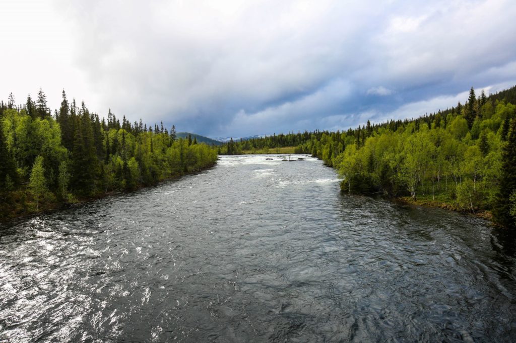
One of the many lakes around Vildmarksvägen
We started after our mini adventure in Wilhemina and within minutes set eyes upon reindeer darting across the road. Some slowed down and trotted in front of us, seemingly not phased by the car behind them. Not being something we ever usually see, we gazed on in awe until a boy on a cycle came hurtling past shouting at the reindeer. It’s surprising that a bike was scarier than a car and within seconds the reindeer had disappeared back into the forest. What a way to start our adventure!
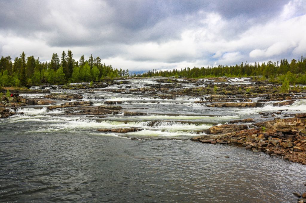
Trappstegsforsen Waterfall
As you travel the Vildmarksvägen, the scenery is ever changing. Our first major sighting was the Trappstegsforsen waterfall near Saxnas. Thankfully there’s plenty of room to pull over and get up close. It looks wonderful as ledges stretch back up the hills and water gushes down towards you.
Further along the route is Fatmomakke, a traditional Sami church town and the biggest of its kind in Sweden. Many of the buildings here are over 200 years old and it’s apparently a great snapshot in to Sami culture. Alas, although it’s highly recommended, we didn’t have time to stop by, due to some confusion about how to get there and a request to be at the accommodation by 9pm.
Top tip; when you follow a sign off the road to Fatmomakke, it’s not actually where the road ends. To get there, cross a long foot bridge. It’s important to factor that in to your plans as getting there and then walking will easily take an hour. Learn more about Fatmomakke here.
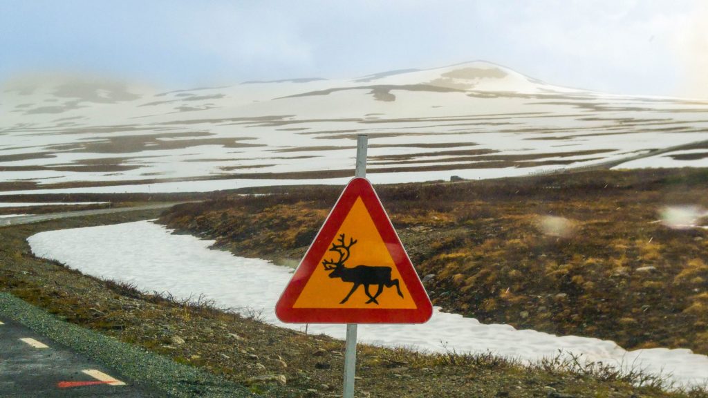
Caution, reindeer are afoot
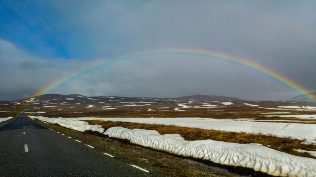
True wilderness really hits when you reach the northernmost point of the route. You’re in Stekenjokk amongst baron field and there’s little to identify any signs of life, apart from a reindeer crossing road sign (safety first kids!). Travelling in June, the weather was still unsettled. As you can see there was snow, rain, sun and a rainbow – all at once!
Stekenjokk gave us a rainbow, snow, wind, rain and sun all at once!
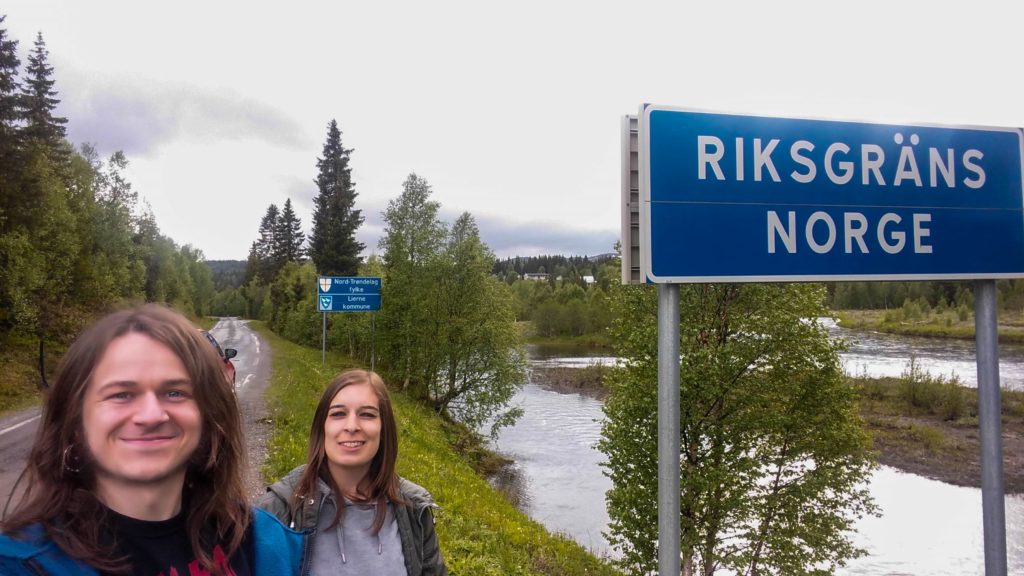
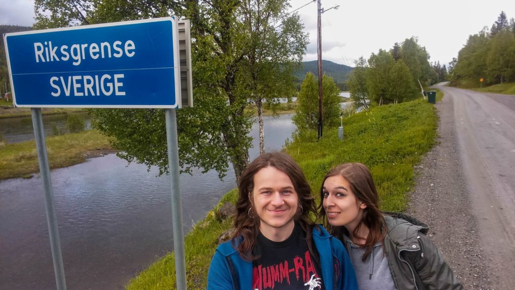
Moving on from Stekenjokk, we felt that as we were so close, we had to do it…make a quick adventure in to Norway!
Norwegian border crossing near the Vildmarksvägen
A border is just an imaginary line, but there’s still something thrilling about crossing from one side to another. Especially when you can stop and do it on foot!
Swedish border crossing near the Vildmarksvägen
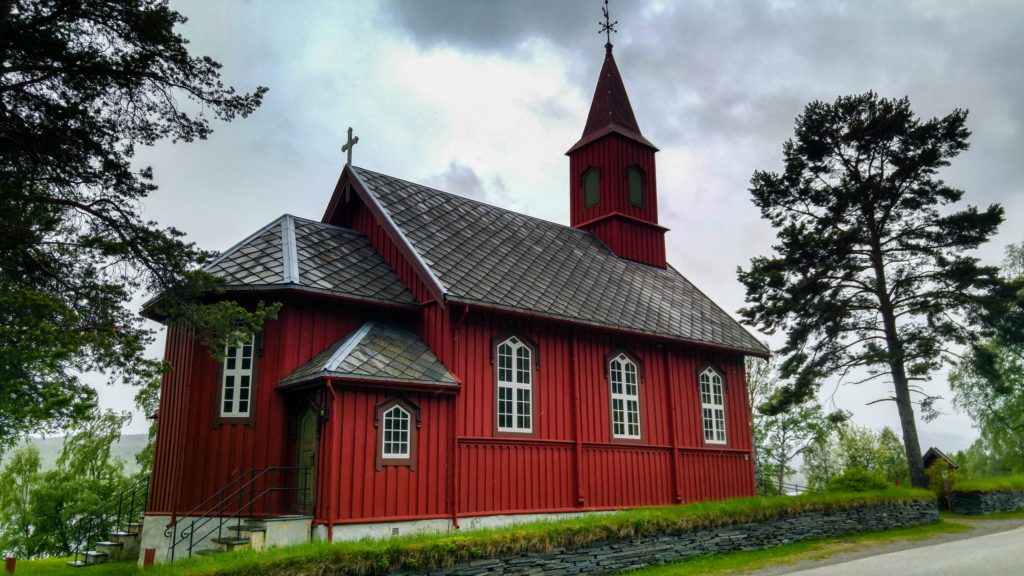
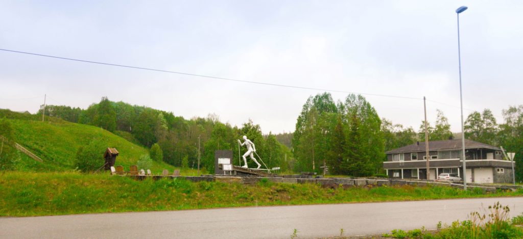
Obligatory border crossing photos taken, we headed off along the dirt roads. Snaking through mountains and admiring the deep red cabins. We also stopped off at a Norwegian red church along the way!
Norwegian Red Church in Lierne
A statue of the Olympic Champion skier Frode Estil in his small hometown of Lierne, Norway
We spent the night at STH Gaddee and it was perfect. Mid June is a little early for most travellers, so the owner was surprised to receive a reservation. Although travelling at this time of year did mean we had the entire hostel to ourselves! He laughed at our adventure and enjoyed hearing about our travels. His wife was a teacher at the local school and we were fascinated to hear her stories about how the Swedish education system works and that she enjoyed teaching Syrian refugees who had come to live in the area.
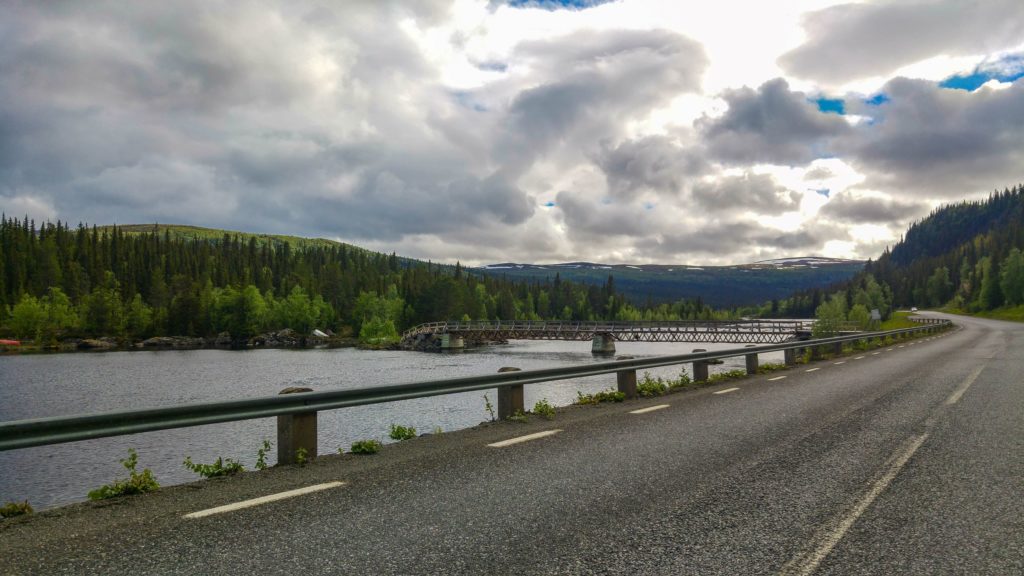
One of the many bridges to cross on the Vildmarksvägen
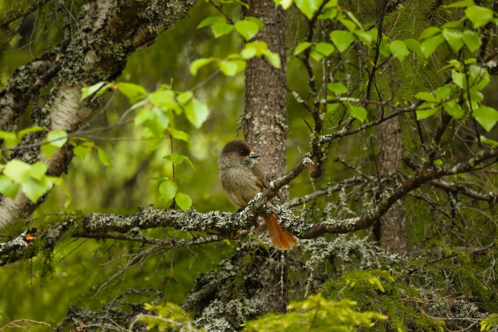
There’s midnight sun this far north in the summer, but we got well rested and left for Hällingsåfallet in the morning. It’s easily signposted from the main Vildmarksvägen route. There a small car park leads to a route with boardwalks in the forest.
A Siberian Jay in the forest near Hällingsåfallet
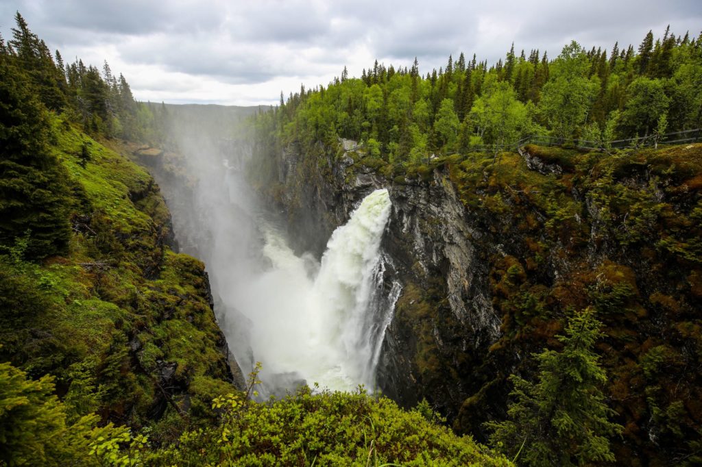
There’s plenty of birds to spot, but the real gem is through the trees when you reach Hällingsåfallet. The biggest waterfall in Sweden gushes out and drops 42m in to the 800m long canyon below. This is truly something special. It’s as if a pipe burst inside the mountain and you’re witnesses the aftermath. Barriers prevent any unfortunate falls, but the paths are slippy. Take care as you get up close and gaze in awe.
Hällingsåfallet Waterfall
This brings an end to our trip around the wilderness route. Next we headed south to get a kayak and look for beavers in the midnight sun! That’s a story I’ll tell soon…
How do I get to the Vildmarksvägen Wilderness Route?
It might be in the wilderness, but it’s not difficult to find. If you’re trip starts in Stockholm, I’d recommend hiring a car at the airport or in the city. It makes getting around so much easier. Bus travel in the area can be difficult and it doesn’t give you the freedom to come and go as you please.
In the car you’ll likely be driving north on the main E45 road. Signs to turn on to the Vildmarksvägen are seen near Strömsund. If driving south on the E45, signs to turn off can be seen when approaching Wilhemina.
Most guides talk about starting in Strömsund, but it doesn’t matter if you drive the route clockwise (approaching from Strömsund) or anticlockwise (approaching from Wilhemina). The scenery is still the same! Use the maps below as your starting point when planning the route.
How long should I spend driving the Vildmarksvägen Wilderness Route?
The route can be driven in about six and a half hours without stopping. You could speed around (and would still have an incredible time), but I’d recommend you split it up in to two days. Accommodation is limited so make the most of allemansrätten (Sweden’s ‘right to roam’, i.e stay anywhere as long as you don’t leave a trace), or we can recommend staying at STH Gaddee. Taking two days gives you time to get out of the car, enjoy the scenery, have a walk, relax and see Hällingsåfallet or other waterfalls. You get the idea, there’s a lot experience,
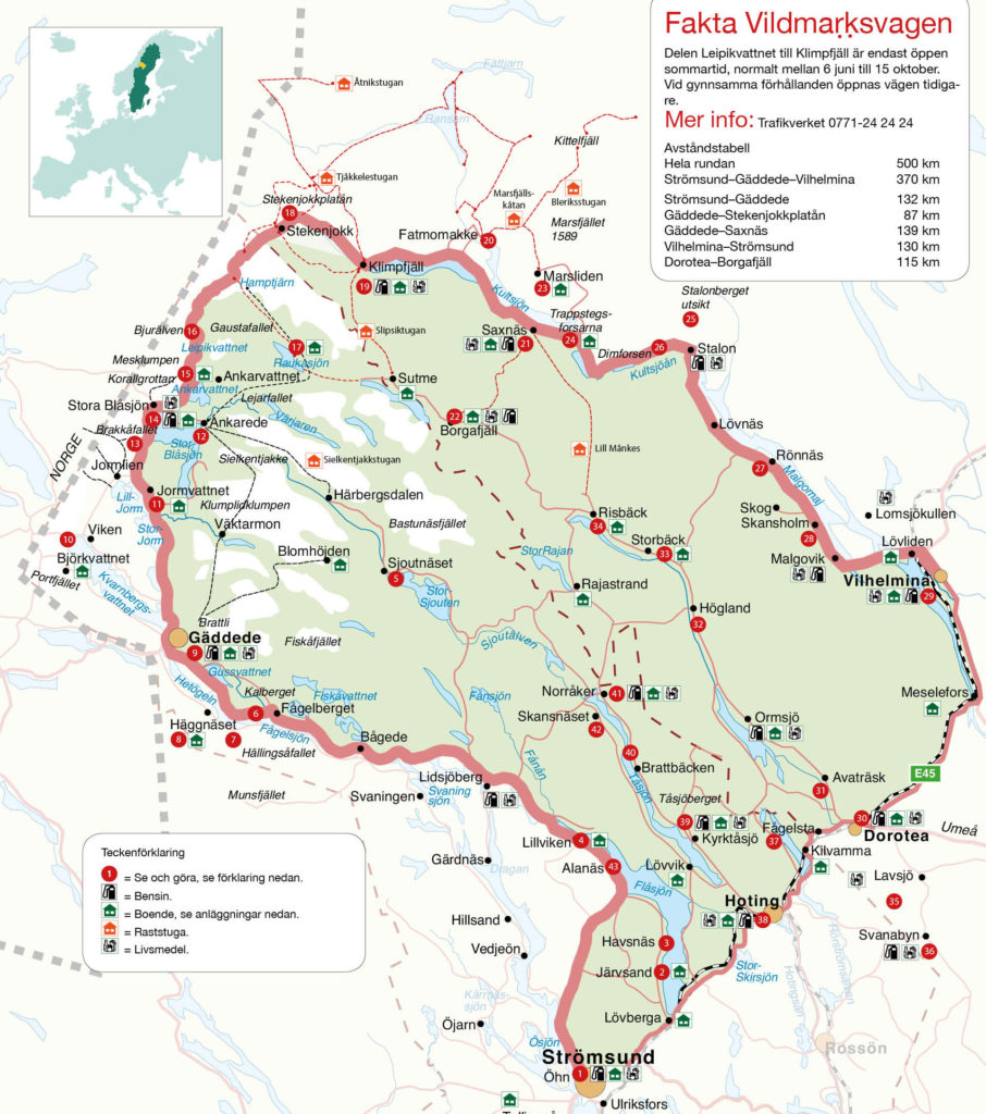
This excellent map and further information is courtesy of the official Vildmarksvägenwebsite.
How much does the Vildmarksvägen Wilderness Route cost?
It’s free (who said Sweden was expensive)! Enjoy the scenery, this is a once in a lifetime experience.
This website uses cookies to improve your experience. By using this website you agree to the use of cookies Ok
Read Privacy Policy
Privacy & Cookies Policy
Privacy Overview
This website uses cookies to improve your experience while you navigate through the website. Out of these, the cookies that are categorized as necessary are stored on your browser as they are essential for the working of basic functionalities of the website. We also use third-party cookies that help us analyze and understand how you use this website. These cookies will be stored in your browser only with your consent. You also have the option to opt-out of these cookies. But opting out of some of these cookies may affect your browsing experience.
Necessary cookies are absolutely essential for the website to function properly. This category only includes cookies that ensures basic functionalities and security features of the website. These cookies do not store any personal information.