Skuleskogen National Park – enter the woods and exit on top of a mountain
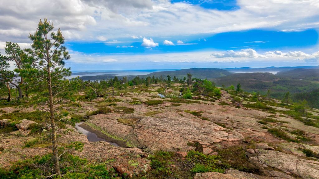
Deep in the woods of the UNESCO World Heritage Skuleskogen National Park are the fantastical Slåttdalsberget mountain and Slåttdalsskreva crevice. Two things we felt were essential experiences on our trip north.
A visit to Sweden wouldn’t be complete without an adventure in the great outdoors. The country has allemansrätte. Also known as “everyman’s right” or “freedom to roam”, it allows anyone to roam free in nature. Sleep in the woods, trek up or ski down a mountain, kayak or swim in a lake, run through a field, pick lingonberries and mushrooms. You’re allowed to do it all without hindrance. The Swedish Environmental Protection Agency ask only one thing, that you avoid private roads and residencies and respect nature (“don’t disturb, don’t destroy”). The beauty is that it’s free too (who said Sweden was expensive?).
Skuleskogen is 500KM north of Stockholm, although it’s not too far off the beaten track to easily find. We decided to enter via the south entrance (see map for directions from the E4 Highway), where there is a 3.1KM marked hiking trail which leads to Slåttdalsberget. There’s nothing but a small car park and a toilet at the south entrance, so bring water and snacks with you. Walking poles were recommended although we didn’t find them necessary. Now it’s time to lace up your hiking boots and head in to the forest.
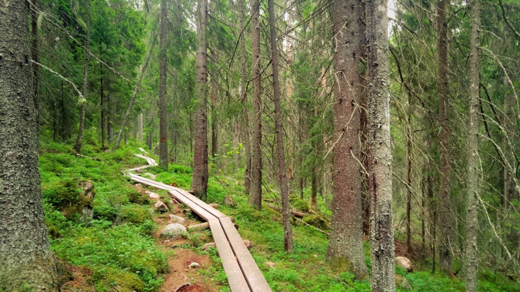
Little orange paint splashes on the trees mark the trail. Keep your eyes open and it’s straightforward to follow. The first section is made up of boardwalks through a vast spruce forest, reminiscent of The Ritual. The movie where hikers get lost and murdered by a demon in a Swedish spruce forest! Demons out of sight, we did see red squirrels and birds, but you’ll need to tread quietly and keep your eyes peeled if you want more than a fleeting glance.
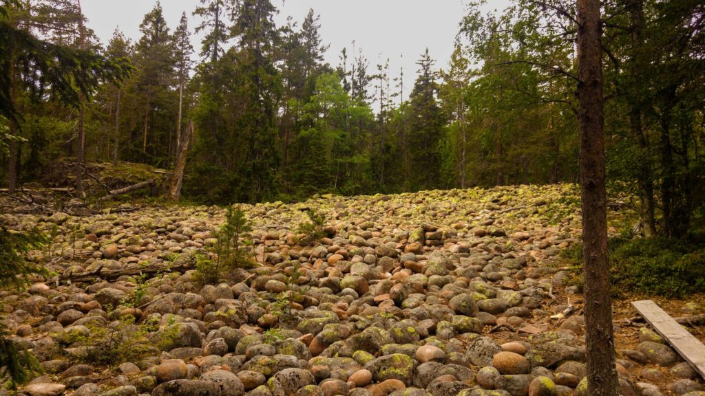
Leaving the forest brings you out to a rocky path and stone field. It looks a strange art installation, but is over 8,000 years old and caused by waves crashing through the area, way back when sea levels were much higher. A sign respectfully asks you not to build a stone tower!
At this stage you’ll have made a steady incline and are a little over half way there, so it’s a good place to take a break on one of the large boulders nearby. There’s likely to be other hikers here and it’s worth pointing out that the the orange path continues straight on. Don’t get confused by others heading in a different direction to you. They’re on the the blue path which I’ll talk about later.
The hike ahead is about to get easier for a short while as you take to a leisurely stroll along a grass field, but upon re-entering the forest you hit some steep winding slopes.
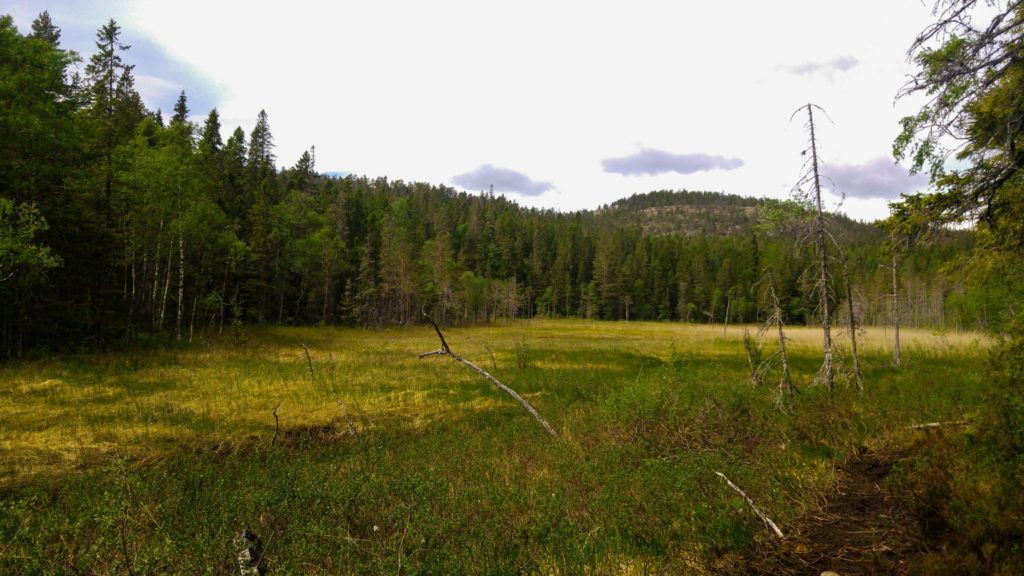
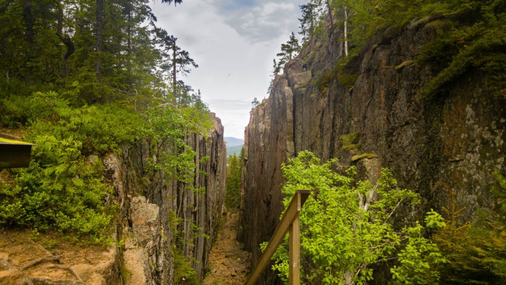
Initially you might think you’ve reached Slåttdalsskreva and that it’s underwhelming compared to the pictures you saw online. Don’t worry! There were plenty of confused faces and people turning back, but this first crevice isn’t the one you came for. There aren’t any signs, but you have to walk through and climb over it to get to the good stuff. When you do, it’s unmistakable that you’re there!
Slåttdalsskreva is 200m long, 30m deep and 7m wide, ripping the Slåttdalsberget mountain in two. It is mightily impressive and feels like something from Lord of the Rings. I can imagine many mystical battles have taken place here (although they probably didn’t).
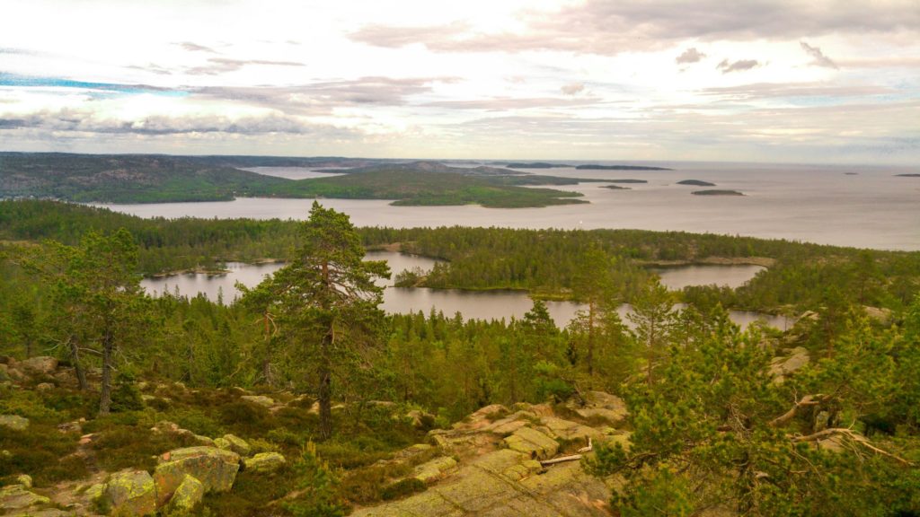
Something you can’t miss is the two minute diversion to the left. You could easily miss this as there’s not set path. Scurry over the rocks and you reach the top of Slåttdalsberget. The views are incredible, as you look out into the Gulf of Bothnia and small forested islands for as far as the eye can see. It’s so peaceful up here.
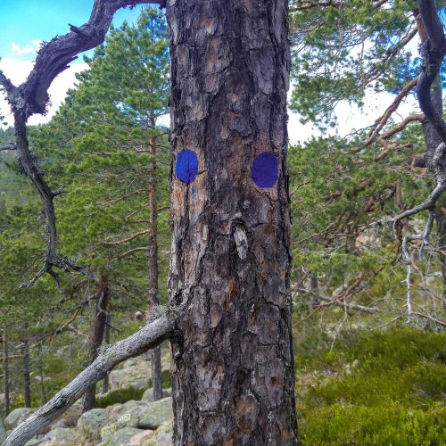
The views don’t end there. If you want to experience something even more spectacular, head back down to the opening of Slåttdalsskreva. Instead of going back the way you came, turn right and on to the blue path. The little blue dots are barely noticeable and you’ll start by climbing rocks and thinking “this can’t be it!” Don’t worry, it is.
It’s now time to venture across mountain tops, scanning a horizon of forests and lakes. It’s a wilderness unlike any other I’d seen before. Rose found suddenly found some tundra cotton amongst the wind battered landscape of stone and trees. This was the only confirmation I needed. We were now in Skyrim! Paying attention to allemansrätte we left the cotton alone and descended down mountain slopes. All the while trying to find the little blue dots that guide the way.
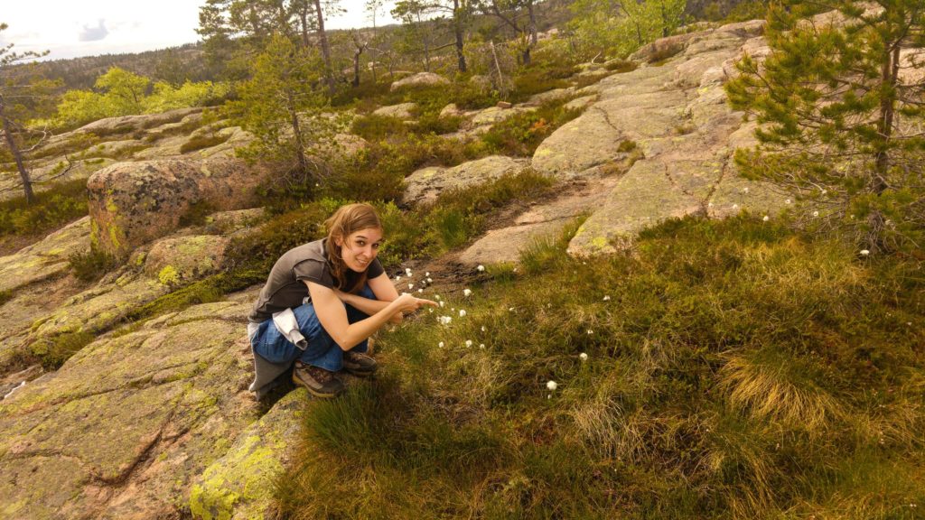
Eventually you’ll see some familiar terrain as it’s the open space where you (probably) took a break earlier. You’re now back on the orange path so might want to rest your feet again, before hitting the home straight. Varying up your adventure with the blue path is essential as the landscape is so different, but a note of caution. At times it can be a steep descent, so I’d recommend doing it on your return journey, rather than splitting off and doing it on your approach to Slåttdalsberget.
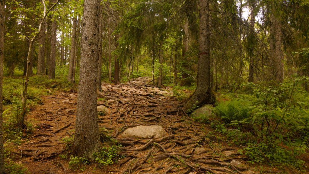
There are longer hikes in the area, but if you’re looking for a one day adventure in the wilderness with stunning views, I can highly recommended Skuleskogen National Park!
How do I get to Skuleskogen National Park?
Skuleskogen National Park is located off the E45 highway between Örnsköldsvik and Härnösand. We undertook the hike from the south entrance. If driving you’ll see signs for Entré Syd (South Entrance). Further details on public transport can be found here.
The Höga Kustenleden (High Coast Trail) also passes by Skuleskogen National Park.
How long do I need at Skuleskogen National Park?
The hike is 3.1km each way, so allowing time for breaks and stopping to enjoy the views, I think five – six hours is a reasonable time for people of all abilities.
How much does Skuleskogen National Park cost?
It’s free and part of allemansrätte.
SHARE THIS POST